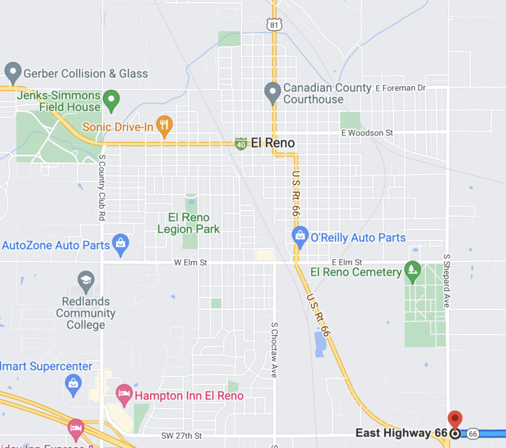
At El Reno’s Shepherd Avenue, Highway 81 comes in from the south and joins Route 66. As they pull through the intersection, Carl, reading the signs, says, “Daddy look, did you see? We’re now on 81 too. Isn’t that the road you said follows the trail the cowboys drove cattle over?”

In the last blog R66-8 about the *Atkins Family’s 1948 U.S. Route 66 journey west, the Atkins family has left Oklahoma City and passed through both Bethany and Yukon Oklahoma.
A few miles out of Yukon, the highway widens and for the family it’s an easy 12-mile drive into El Reno.
Coming into El Reno and as they approach Shepherd Avenue, road signs inform them that Route 66 continues west past the intersection and then curves to head northwest.
Luke says, “This is different. Last time we went through here in 1944, you had to turn here and go north up Shepherd.”
They also see that Highway 81 comes in from the south and joins Route 66. As they pull through the intersection, Carl, also reading the signs, says, “Daddy look, did you see? We’re now on 81 too. Isn’t that the road you said follows the trail the cowboys drove cattle over?”
“Yes, the Chisholm Trail, but I said it mostly did. I don’t know how exact that is, but I do know the trail’s western branch went through El Reno. The trail separated into two branches right before they had to cross the Canadian River.”
“Why did it do that?”
“Well, the way I understand it is – they drove the cattle down the eastern branch, and it went through Yukon; Stagecoaches or Freight wagons went the western route through El Reno and took an easier Canadian River crossing. The trails came back together after crossing the Cimmaron River. So, I’d say it was all about the river crossings. The stagecoaches and wagons needed an easier route.”
“So, we’re going about where the Chisholm Trail Stagecoaches went right now.”
“Yep, for just a bit we are.”
“I wish we could follow it all the way.”
“Maybe we will someday, but not now. Now we’re heading west, not north.”

The western branch of the Chisholm Trail passed through what is now Legend’s Park in El Reno. There is a marker at the intersection of W. Pine and S. Keith Ave. on the NW corner of Legion Park.
Chisholm Trail Marker (Credit: Waymarking.com)
Luke follows the curve onto the four-land road heading northwest toward downtown El Reno, which is both Route 66 West and Highway 81 North.
On the way, being accustomed to navigating, Grace has unfolded and is looking at the Oklahoma map.
She says, “When you get to Elm Street, 66 goes straight north for about 10 blocks to Wade Street. You’ll turn west there, go a couple blocks to Choctaw Avenue, then back north a couple more blocks. Then 66 turns west on Sunset Drive and heads out of town.”
“Thanks for that,” Luke says, “I think from Elm Street it’s the same as it used to be in 1944.”
“I think you’re right, but this four-lane road we’re on now is a lot better than I remember.”
“Yes it is.”
Just after they pass El Reno water tower on the left, they reach the intersection of Elm Street and Rock Island Avenue.

1948 Water Tower (gateway.okhistory.org)
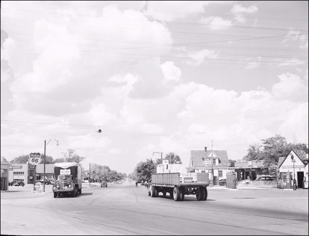
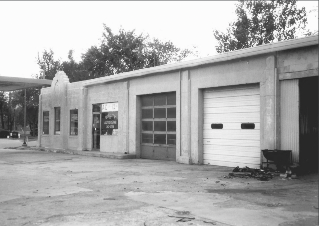
1940s E. Elm Street and Rock Island Avenue (odot.org)
In the above 1940s picture of the intersection of E. Elm and Rock Island Avenue, both the Phillips 66 station on the left and the cottage station on the right is gone. The oblong box station behind the cottage still exists but is now an auto repair shop.
In 1948 El Reno was a thriving town with a population of just over 10,000; it was the seat of Canadian County and situated not far from the south bank of the North Canadian River.
El Reno, located at the junction of two historic highways, the east-west Route 66 and the north-south Highway 81, gets its name from Fort Reno located a few miles west of town; it was founded when the Rock Island Railroad was routed to the site two months after the Run of April 22, 1889.
The federal government created Counties in the new Oklahoma Territory prior to the run; this one was County Four, but following the run was renamed “Canadian County”, after the Canadian River which runs through it.
Luke continues directly north along with Route 66 and Highway 81 for about 10 blocks to Wade Street.
Here, he turns Left. They are now in downtown El Reno amongst many red brick buildings from the late 1800s and early 1900s. Two blocks later they reach Choctaw Avenue.
According to street signs at this intersection, both 66 and 81 turn directly north, but Luke looks around for a place to pull off the road. On the Southeast corner is a cottage style station. On through the intersection on the northwest corner is the Avant Service Station where he pulls into the drive and stops short of the gas pumps; he turns to Grace, “Speaking of Highway 81, that reminds me of something. Can you hand me the map?”
Grace does and Luke studies it a minute, then hands it back to Grace and says, “I got it now. I’m going to take a little detour.”
The cottage style stations like this one on the southeast corner of Wade Street and Choctaw Avenue were prevalent in the nineteen thirties and forties; they were scattered all along Route 66, built in this home-cottage style to blend in with the Route 66 neighborhoods and towns of the time, in hopes of attracting travelers with their homey friendly ambiance. They were popular with Conoco and other oil companies like Phillips 66 who built over 300 Cottage Style stations between 1928 and 1945.
This one, Jackson’s Conoco Service Station, was built by Conoco in 1934, and referred to by them as the “house-with-bays” style. With its brick walls, steep pitched gabled roof, and chimney, it resembled a small residential home.

Jackson’s Conoco. SE corner of W. Wade and Choctaw Ave. (theroute-66.com)
The Avant Service Station, diagonally across the road from Jacksons is an Art Deco service station built by Tom Avant in 1933 on the northwestern corner of the busy intersection. It was a Cities Service Oil Co. station, and it had a streamlined appearance with a flat roof. Its original color was white with green trim, that of Cities Service’s brand.
Avant station in 2003 NW corner of W Wade and Choctaw Ave (npgallery.nps.gov)
In 1948, on the southwest corner of S. Choctaw Avenue and W. Wade Street, the El Reno Hotel stood; it was built in 1892 just three years after El Reno was founded. This two-story frame structure is the oldest commercial building in El Reno, and typical of its time.
Currently, after being moved in 1984, it sits adjacent to and on the south side of the Canadian County Museum.

El Reno Hotel 300 S. Choctaw Avenue – Image about 1909 (Canadian County Museum, Roy Tate Collection)
Instead of heading north with Route 66 and Highway 81, Luke pulls back out on Wade Street and continues west.
He says, “Back in the early thirties, in my train-hopping days, I jumped off here once and the train station is just up this street a bit.”
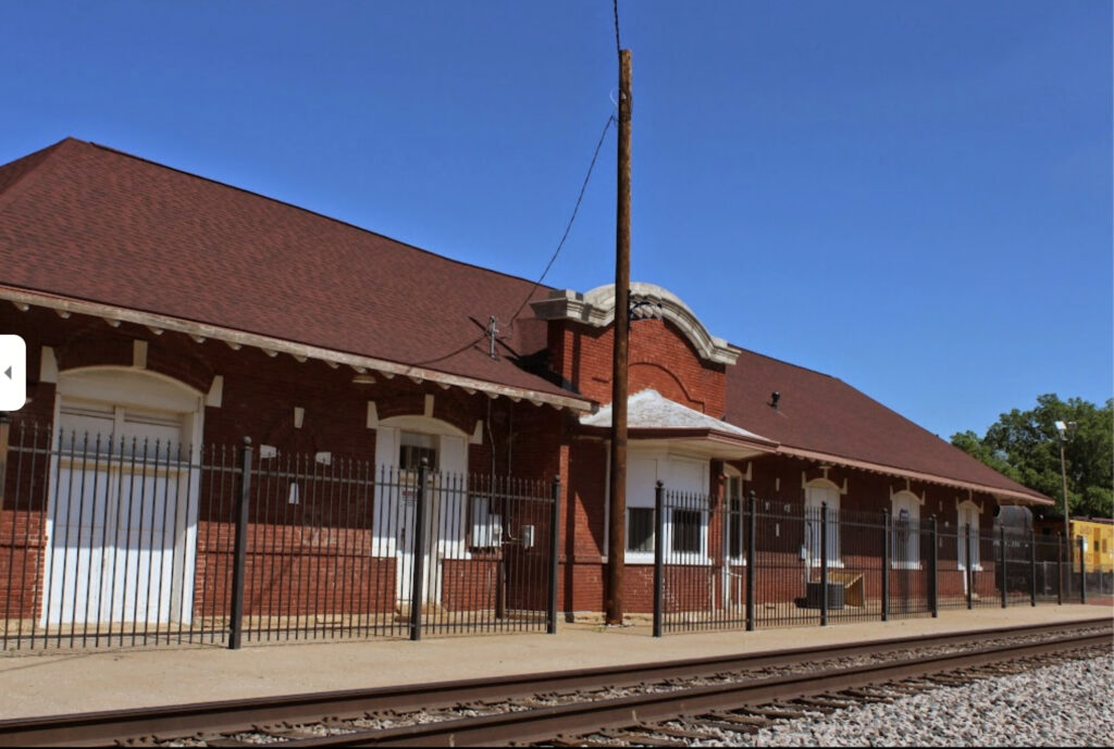
At the end of Wade Street just past Grand Avenue, Luke comes to a stop at the Rock Island Train Station to give the family a look at the depot and the tracks.
Rock Island Station (Canadian County Museum)
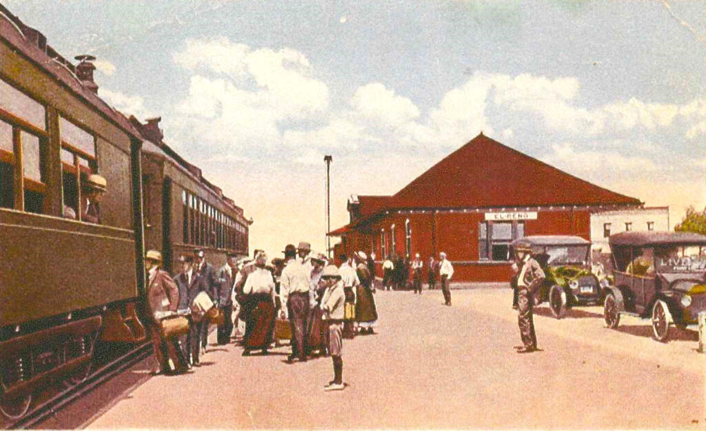
Rock Island Station, c1920. (Canadian County Museum: Tommy Neathery Collection.)
By 1892, the Chicago, Rock Island & Pacific (the “CRI&P”, “Rock Island”, or “The Rock”) had completed its north-south line from Kansas to Texas following the Chisholm Trail and going through El Reno Oklahoma. The Rock Island depot is a one-story red brick structure with a red tile roof built in 1907.
The depot was a working railroad station until the early 1970s. Currently, owned by the Canadian County Historical Society, it houses the Canadian County Historical Museum.
Carl asks, “Where were you before you came here?”
“I was coming in from Kansas City on the Rock Island. The tracks pretty closely follow the old Chisholm trail too, just like 81. That’s what brought it to mind. Boy, I remember sitting in that boxcar with the huge heavy side door slid back enough to see out. All the way south I was watching Highway 81 and the scenery, going across some of the prettiest red dirt country you’ve ever seen, and the train rocking big from one side to the other most of the way here.”
“Did they make you pay when you got off at the station?”
“I unloaded a few blocks back. I didn’t want to be too close to the Rock Island Office building on Watts Avenue a couple blocks before the station, where flagmen might be waiting, or the Rock Island depot where I might get in worse trouble. The rocking had smoothed out a bit coming into town but still I had to wait till the train slowed enough and then time my jump to the rock.”
“That sounds exciting. I want to do that.”
“That was a different time. I wouldn’t do it now. I was reckless; didn’t have the sense God gave a goose back then.”
At this, Grace laughs, and the kids join in.
Luke starts turning the car around to head back east on Wade Street.
Why did you get off here?
“Well, I had a traveling buddy and we got separated a while before that and I was on his tail, trying to hook up again. I heard he was here.”
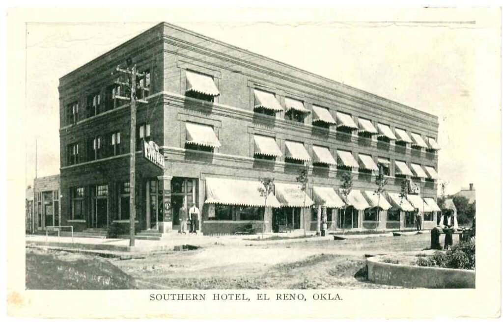
Down the street a block Luke slows and motions toward the Southern Hotel beside them at the corner of Wade and Grand Avenue, “heard he got a job on the night cleaning crew at that hotel right there.”
Southern Hotel about 1910 (Canadian County Museum)
“Did you find him”
“Nope. Just missed him. I asked the guy behind the desk; he said he worked faithfully until he got his first check then just disappeared. So, I figured he caught a train out.”
“What did you do then?”
“Just walked around for a while. Finally, after I got me something to eat, I headed back here. There was an interurban that also ran around town, and its terminal was at the Southern. I could have taken that back, but I didn’t want to spend the money, so I walked. Then I picked me out a spot to wait to hop the next train out heading south.”
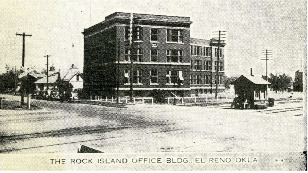
The Southern Division Headquarters (Rock Island Reporter)
Rock Island’s Southern Division Office was located in El Reno on Watts Avenue a couple blocks up the tracks to the northeast of the depot.
Currently, the building stands but has been converted into apartments.
The Interurban Railroad traveled eastbound to Oklahoma City from 1911 connecting Oklahoma City, Yukon, and El Reno. The rail cars left from the Southern hotel every hour. The around town cars left every thirty minutes. By the end of 1947 the line had been abandoned and the tracks removed.
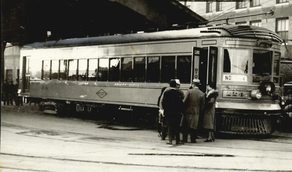
Interurban (okmag.com)
Luke returns to the intersection of Wade Street and Choctaw Avenue. From here he turns north onto Route 66 and Highway 81 and travels the couple blocks or so to Sunset Drive where Route 66 turns left/west, and Highway 81 continues north. Luke will turn left, and Sunset Drive/Route 66 will lead the family out of El Reno, Oklahoma.
* * * * *
Coming Next – Leaving El Reno – to Pony Bridge & Caddo County
Notes:
*The Atkins Family: Luke (Father, 38), Grace (Mother, 29), Carl age 10,) Darla (age 6,) Nancy (age 4.)
Because of my need to slash the word count of my book considerably, many cuts are those that added to historical value rather than story. It makes me sad because I like those historical references. I hope that by presenting those and my additional research here, I can share an authentic 1948 trip down Route 66 and add a little extra as I go.
My parents made a real 1948 trip to California and my mother kept a diary, which I faithfully used in planning this fictional trip.
Credits:
Jack DeVere Rittenhouse, (1946). A Guide Book to Highway 66
Route66times.com (https://www.theroute-66.com/el-reno.html)
Okmag.com: Remembering the Railways pdf.
www.okhistory.org Encyclopedia of Oklahoma History and Culture
Rockislandreporter.com: oklahomaguidetos00writrich.pdf
Wikipedia.org
Oklahomarailwaymuseum.org
Worldatlas.com
Theroute-66.com/elreno.html
Waymarking.com
Image Credits:
Standard:
1937 Chevy 4-door Sedan: Photoshop on personal picture.
R66 Shield pngegg.com
For this Blog Episode:
01 Route66 Thru Reno Recent Google Screenshot crop
02 Chisholm Trail Marker www.waymarking.com
03 El Reno Water Tower, 1948 gateway.okhistory.org
04 Elm & Rock Island Intersection www.theroute-66.com, odot.org
05 Jackson Conoco Service Station www.theroute-66.com/el-reno.html
06 Avant Station npgallery.nps.gov
07 El Reno Hotel Canadian County Museum (Roy Tate Collection)
08 Rock Island Train Station Canadian County Museum (Tommy Neathery Collection)
09 Rock Island Station from Wade Canadian County Museum
10 Southern Hotel Canadian County Museum, Roy Tate Collection
11 Interurban okmag.com
12 Rock Island Division Building rockislandreporter.com
thanks, interesting read
+ for the post
thank you very much
interesting news
thanks, interesting read
_________________
ставка компаниясы Olympus kz
thanks, interesting read
_________________
Азаматтық спорттық ставкалар
very good
_________________
казино онлайн на деньги на бонусы
thanks, interesting read